








Flood Situation Near the Gandak River: How Flood-Control Infrastructure Can Protect Bihar’s Settlements
The Gandak River has triggered a fresh flood emergency in parts of Bihar, putting settlements and agricultural areas in West Champaran and neighbouring districts under pressure. Bihar’s...

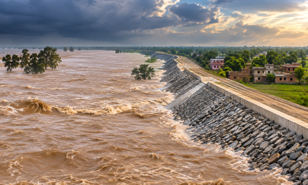
The Gandak River has triggered a fresh flood emergency in parts of Bihar, putting settlements and agricultural areas in West Champaran and neighbouring districts under pressure. Bihar’s official flood-monitoring system showed the Gandak above danger levels at several monitoring stations on September 28, including Dumariaghat, Khaddah and Thakraha. The river was also above the warning level at other locations.
The situation became particularly serious in West Champaran after a section of the Champaran embankment reportedly breached, allowing floodwater to enter residential areas and villages. Local reports said the breach affected hundreds of villages and contributed to flooding in Bagaha.
The immediate challenge is emergency response, but the episode also highlights a larger infrastructure question: how can Bihar protect settlements that lie along highly flood-prone river systems?
One of the most important requirements is stronger embankment management. Embankments are designed to keep river flows away from inhabited areas, but their effectiveness depends on regular inspection, maintenance and rapid identification of vulnerable sections. A breach can transform a manageable rise in river level into a major settlement-level disaster.
Flood forecasting is another critical component. Bihar’s official flood-forecasting system already tracks river levels against warning and danger thresholds. On September 28, for example, the Gandak at Dumariaghat was recorded at 63.58 metres against a danger level of 62.22 metres.
Such information becomes most valuable when it reaches communities quickly. Early-warning systems, village-level communication networks, evacuation routes and designated shelters can reduce the time between a flood alert and the movement of residents.
The Gandak episode also demonstrates why flood management cannot depend entirely on embankments. Roads, bridges, culverts and drainage channels need to be designed to remain functional during high-water events. Bihar authorities had already directed increased monitoring of bridges, culverts and connectivity routes as the river situation worsened.
For agricultural communities, the infrastructure challenge is even broader. Flooding can damage roads and electricity networks while simultaneously submerging standing crops and disrupting access to markets.
The long-term answer therefore involves a combination of structural and non-structural measures: stronger embankments, river monitoring, floodplain management, resilient bridges, improved drainage, emergency shelters and better early-warning systems.
The Gandak’s latest rise is a reminder that flood-control infrastructure is not simply about constructing larger barriers. It is about building a network that can anticipate rising water, protect settlements and maintain essential connectivity when rivers cross their normal boundaries.








No Comment! Be the first one.