








How AI and Mobile Mapping Are Changing Railway Asset Management
Railway infrastructure managers face a persistent challenge: keeping digital records aligned with the physical condition of tracks, signals, masts and other assets. As networks expand and maintenance...

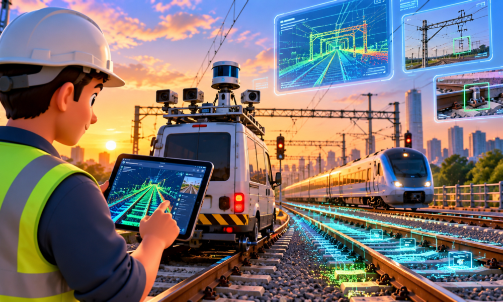
Railway infrastructure managers face a persistent challenge: keeping digital records aligned with the physical condition of tracks, signals, masts and other assets. As networks expand and maintenance work continues, databases can become outdated, while manual inspections demand time, staff and access to operational railway lines.
A technology approach demonstrated by infrastructure software company infraView combines mobile mapping, artificial intelligence and specialist verification to address these problems.
In a Railway-News report published on 19 October 2026, infraView described how its X2BIM.lira and X2BIM.objects tools support railway clearance analysis and asset database reconciliation. The solutions use captured infrastructure data to help identify potential clearance infringements and discrepancies in existing asset records.
Why railway clearance matters
Railway clearance refers to the space that must remain available around a track for trains and their loads to pass safely. Trackside structures, platforms, bridges, equipment and other objects must remain outside the relevant clearance envelope unless specifically permitted by the applicable engineering requirements.
The challenge becomes particularly important when railways need to accommodate oversized or abnormal loads. Operators must establish whether a proposed load can pass through a route without colliding with infrastructure.
Traditional clearance assessments can involve field inspections and measurements. On extensive networks, repeated manual checks can be labour-intensive and may require teams to work near operational tracks.
Digital measurement tools can help infrastructure managers identify locations requiring further investigation and maintain a more consistent record of the track environment.
How mobile mapping and point clouds work
Mobile mapping systems capture infrastructure data while moving along a route. Depending on the system, this can involve laser scanning, cameras, positioning technology and other sensors.
The resulting datasets can include three-dimensional point clouds and panoramic imagery. Point clouds represent the surrounding physical environment as collections of measured points, enabling software to reconstruct trackside geometry and measure distances.
According to infraView’s Railway-News material, X2BIM.lira supports visual analysis of potential clearance issues using mobile-mapping data, while X2BIM.objects applies AI to identify infrastructure assets and compare them against existing databases.
Railway-News
The practical benefit is the ability to conduct more analysis from an office environment, reducing the need to send teams to the track for every initial assessment. Field verification may still be necessary when a potential infringement is identified or when safety-critical decisions require confirmation.
AI for infrastructure asset reconciliation
Railway networks contain large numbers of physical assets, including signals, masts and other equipment. Their records may become inaccurate when infrastructure is replaced, relocated or modified without corresponding database updates.
X2BIM.objects is designed to identify assets in captured data and compare them with the records held in existing infrastructure databases.
This process can help highlight missing assets, discrepancies or records that require further review. Cross-checking information from imagery and point clouds can also help specialists assess the reliability of detected objects.
AI does not eliminate the need for engineering judgement. Detection accuracy depends on the quality of the captured data, visibility, environmental conditions, classification methods and the completeness of existing records.
What this could mean for railway operators
More reliable infrastructure data can support maintenance planning, route assessments, project design and the management of engineering changes. It can also improve the consistency of records used by different teams.
For railway operators, the opportunity lies in reducing repetitive manual work while directing field inspections towards locations that genuinely require attention. For freight operators, better clearance information may support route planning for oversized cargo.
However, digital tools are not a substitute for safety standards, formal inspections or railway-authority approval. Their value depends on integration into established engineering and maintenance procedures.
The next stage of railway digitalisation
As transport networks become more data-driven, the quality of infrastructure information will increasingly influence how efficiently operators plan maintenance and investment.
The infraView example illustrates how mobile mapping and AI can help bridge the gap between digital records and physical infrastructure. The long-term test will be whether such workflows produce sufficiently reliable information, integrate with existing railway systems and deliver measurable improvements in inspection time, data quality and operational planning.
FAQs
- What is railway clearance analysis?
It assesses whether trackside structures and other objects remain outside the permitted space required for trains and their loads.
- What is mobile mapping?
It captures geospatial and visual information while a vehicle or other mobile platform moves through an environment.
- How can AI help with railway asset management?
AI can identify infrastructure objects in captured data and compare them with existing records, helping teams find discrepancies.
- Does AI replace railway inspections?
No. It can support screening and analysis, but safety-critical decisions and required inspections still need appropriate engineering verification.





No Comment! Be the first one.