








East Champaran Floods: How Embankment Breaches Are Putting Roads, Railways and Rural Connectivity at Risk
The East Champaran floods have once again highlighted the vulnerability of Bihar’s transport and flood-control infrastructure as the Gandak River continues to rise following heavy rainfall in its...

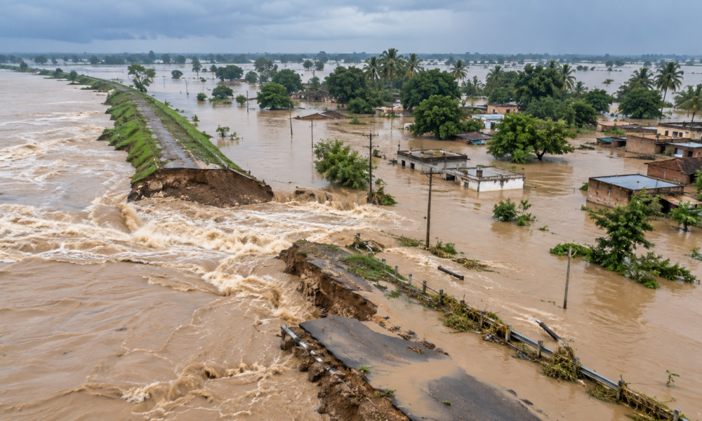
The East Champaran floods have once again highlighted the vulnerability of Bihar’s transport and flood-control infrastructure as the Gandak River continues to rise following heavy rainfall in its catchment areas.
A protective ring bund near Sareya in East Champaran was breached, allowing floodwater to enter nearby villages. Reports said several areas were inundated by around 3 to 5 feet of water, while homes, agricultural land and local connectivity were affected.
The latest flooding is part of a wider situation across north Bihar. The Gandak discharge at the Valmikinagar barrage reached about 5.43 lakh cusecs, with flows remaining above 5 lakh cusecs for several hours. Authorities placed multiple downstream districts, including West Champaran, East Champaran, Gopalganj, Saran, Muzaffarpur and Vaishali, on high alert.
For infrastructure planners, the immediate concern extends beyond submerged homes. Flooding can damage road surfaces, weaken road shoulders, erode embankments and compromise bridges and culverts. Bihar’s Road Construction Department recently said flood damage had affected roads across several districts, including East and West Champaran, Saran and Muzaffarpur. Repairs have included strengthening damaged stretches, filling erosion-created ditches and repairing bridges and culverts.
Rural connectivity is particularly vulnerable because many villages depend on a limited number of roads and bridges. When those links are flooded or damaged, emergency services, agricultural transport, schools and local commerce can all be disrupted.
The East Champaran situation also underlines the importance of maintaining flood-control structures before extreme water levels arrive. Embankments, ring bunds, drainage channels and river-management infrastructure need regular inspection, strengthening and monitoring, particularly in regions exposed to repeated high flows.
Railway infrastructure faces a similar challenge. Flooding and riverbank erosion can affect tracks, bridges and approaches, requiring temporary speed restrictions, route changes or cancellations where safety is compromised. Recent flooding elsewhere in Bihar has already led to railway disruptions and cancellations.
The broader infrastructure lesson is clear: flood resilience cannot depend on embankments alone. Roads, bridges, drainage systems, railway assets and emergency access routes need to be planned as one interconnected network.
As extreme rainfall and high river discharges increasingly test existing infrastructure, Bihar’s flood-prone districts offer an important case study in why resilient design, preventive maintenance and rapid-response systems must become integral to rural infrastructure planning.









No Comment! Be the first one.